Bathurst
Three years ago I moved to Bathurst to study Nursing at the Charles Sturt University located at the bottom of Mount Panorama, this town has now became my home and I wanted to learn more about this place. Before moving here I only knew of Bathurst for two reason one that a gold rush happened here and two the race track Mount Panorama. I will always remember driving into Bathurst for the first time and seeing those big white words on top of the mountain.
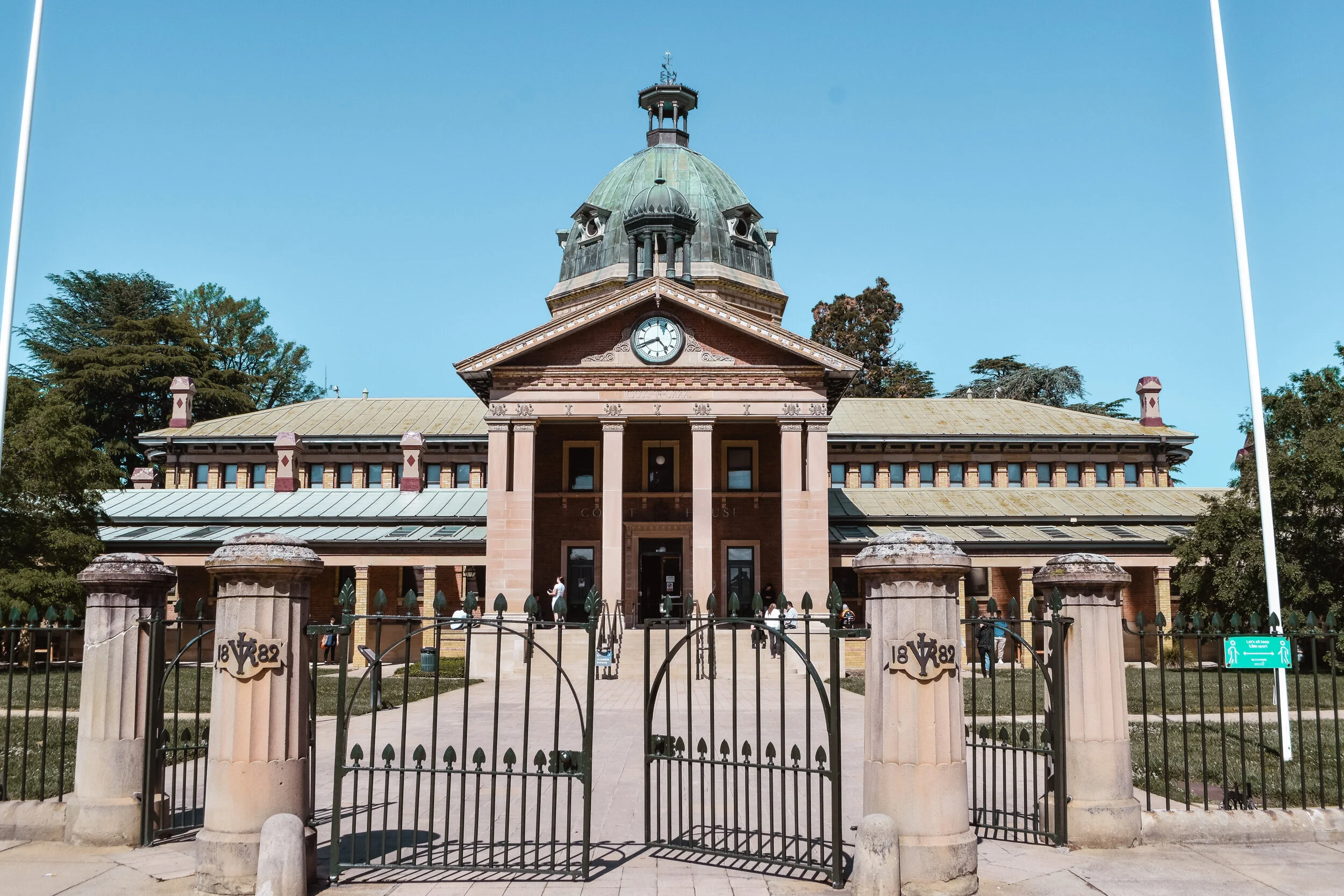
Some of the first things I learnt about Bathurst was from the entry signs into the town that the Bathurst region rests within the traditional lands of the Wiradjuri people and that it is also Australia’s first inland settlement with the date 1815. On the entry signs are also drawings of some of the key historical locations of Bathurst the lamp posts, The Court House and the Bathurst War Memorial Carillon.


Over the years I have read books, searched the internet and read plaques at certain locates throughout the town to learn more about Bathurst. The government surveyor, George Evans, was the first European to sight the Bathurst Plains in 1813, following the first successful European crossing of the Blue Mountains in the same year. In 1814, Governor Lachlan Macquarie approved an offer by William Cox to build a road crossing the Blue Mountains, from Emu Plains to the Bathurst Plains. Governor Macquarie surveyed the finished road in April 1815 by driving his carriage across it from Sydney to Bathurst. I am currently reading and learning more about the Flag location and the Cox Road route so I will have a post post about this further in the future.

1815 - The Flagstaff on the Macquarie (Wambool) River Bank – John W. Lewin who travelled with Governor Macquarie to Bathurst
On 7 May 1815, Governor Macquarie at the end of Cox’s Road raised the flag, ordered a ceremonial volley to be fired and proclaimed and named the future town of Bathurst after the Secretary of State for War and the Colonies, Henry Bathurst, 3rd Earl Bathurst. This made Bathurst the first inland settlement in colonial Australia. It was intended to be the administrative centre of the western plains of New South Wales, where orderly colonial settlement was planned.
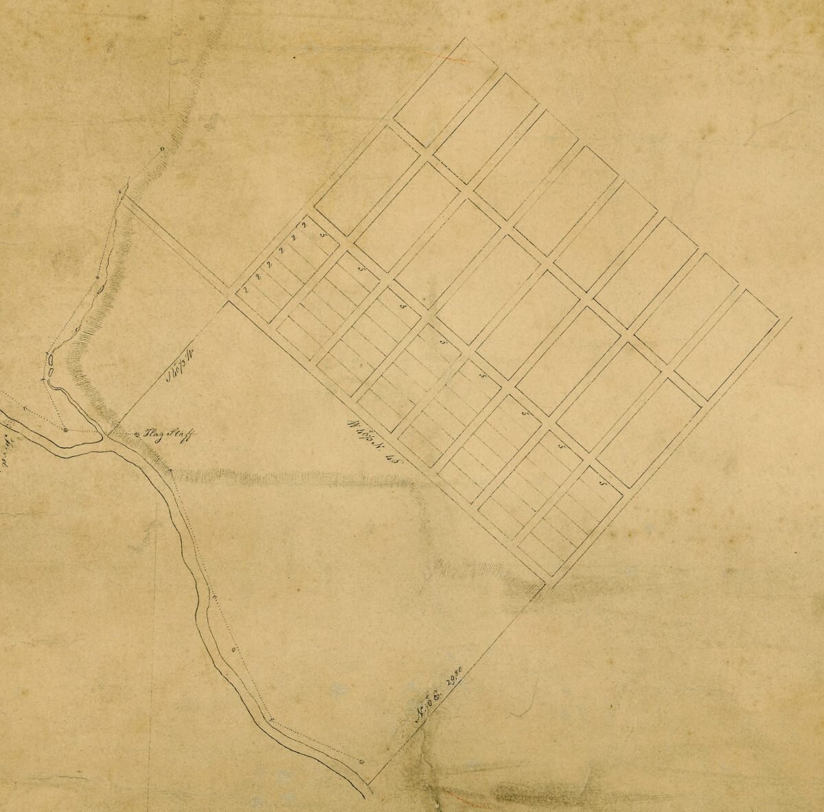
Below are some of the first map drawings of Bathurst.
Top Map: Dated 1815 - Macquarie Town Plan of Bathurst
Bottom Map: Dated 1833 - Mitchell Town Plan of Bathurst