
Queen Charlotte’s Vale Road - Perthville
Recently I purchased a book from Bathurst District Historical Society called Queen Charlotte’s Vale Road compiled by Clive Hamer. I purchased the book as I wanted to learn more about the beautiful area I live in here in Perthville. Back in November I did a blog post about the old Perthville Railway Station and I also tried to share some information I learnt about Perthville over the years.
From the Perthville Railway Station blog post:
Perthville is a small town approximately 10 kilometres from the regional city of Bathurst. The town has evolved over the years. At first "Perthville" was known as Queen Charlotte's Vale, after Queen Charlotte's Vale Creek which runs alongside Vale Road. Vale Road originally carried heavy traffic in laden bullock and horse drays and the settlement began to cater for the bullockies and coach travellers. It was proclaimed a village in 1855 and named "Perth". However, in 1908, to avoid confusion with Perth in Western Australia it was re-named as Perthville.
The Book Queen Charlotte’s Vale Road is almost a self guided historical tour starting in South Bathurst on the Corner of Rocket Street and Bent Street which is the start of the Vale Road. I recently decided to re-create the route. I will not have all the locations that are in the book.
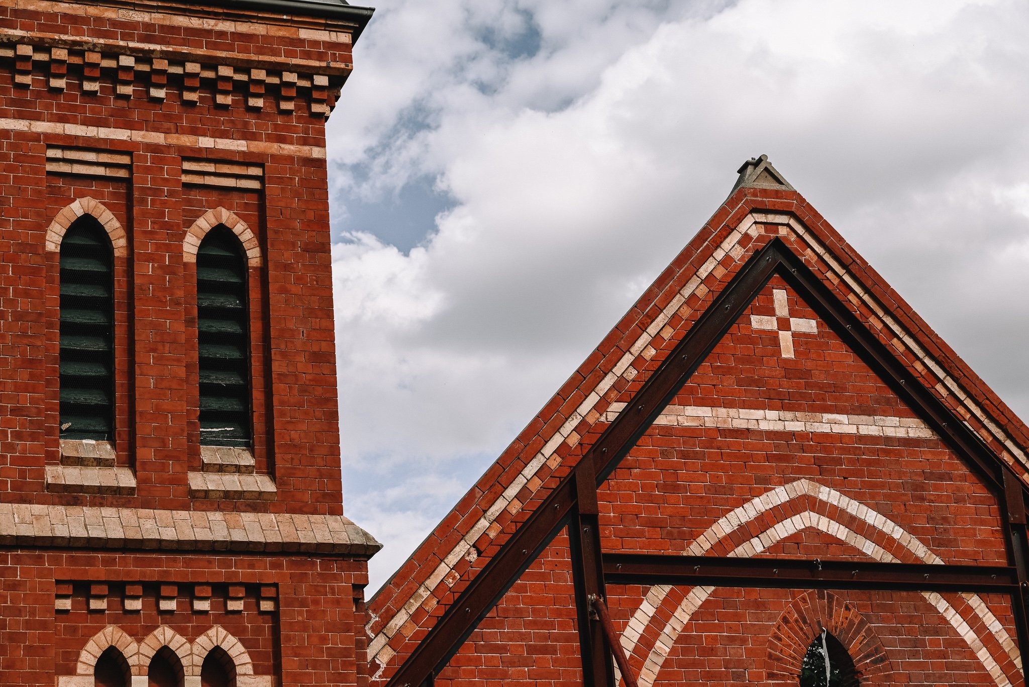
Location 1: Saint Barnabas Anglican Church
Saint Barnabas Anglican Church is located on Rocket Street on the left of the bridge


Location 2: Jolly Hurlers Inn
This location on the Historical Tour is actually no longer here. There also seems a little confusion over the exact location where the Jolly Hurlers pub was located on the block. From the information I have found the Jolly Hurlers Inn was located where service station is now across from the church location 1.

A list of Hotels and Taverns in the Bathurst directory in 1862 from Theo Barker’s book history of Bathurst.
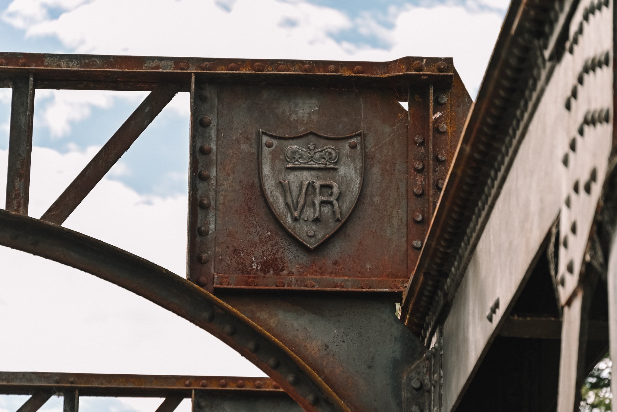
Location 3: Rocket Street Bridge
Once you cross the Rocket Street Bridge you are at the start of the Vale Road. Rocket Street Bridge is one of four Colonial bridges in Bathurst. The Rocket Street Bridge was completed in 1889 making the bridge 133 years old this year in 2022.


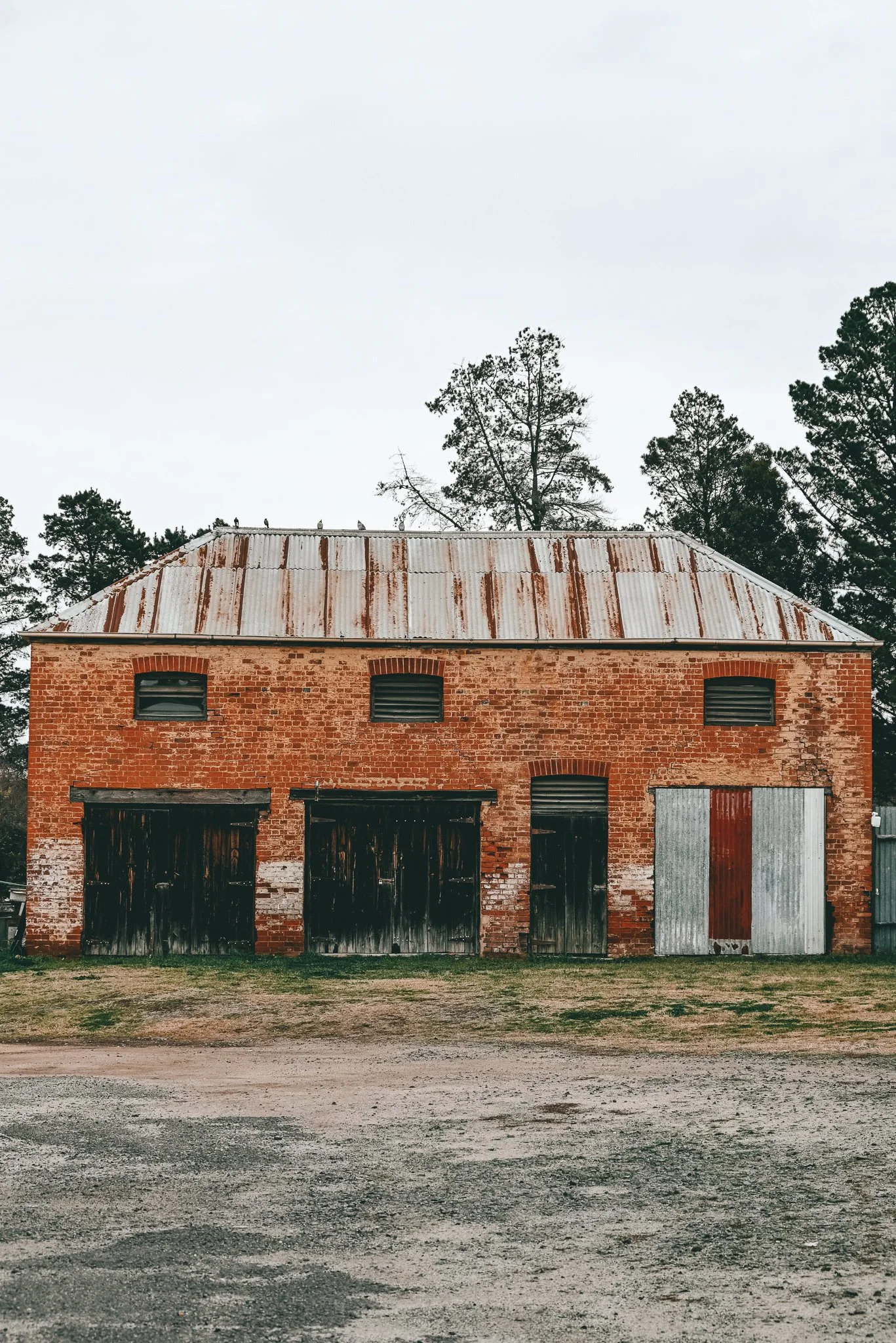
Location 4: Mrs Mutton’s store and Hugh McDiarmid’s store
On the evening of 3 October 1863, Ben Hall’s gang paid a visit to Bathurst as they were planning on stealing a valuable racehorse from the Sportsman’s Arm Hotel (now the Dudley Hotel) on the corner of Piper Street and Stewart Street. Bathurst was thrown into a state of great excitement by the announcement that the gang had committed a series of robberies on the Vale Road.
Their first visit was to a store kept by the Mutton family on the Vale Road. The store happened to be closed and all the doors fastened, so that they could not obtain an entrance without resorting to force. The bushrangers paid a visit to the owner's mother, who resided near the store. She refused to let them have the key of the store. They then searched her house, and whilst turning over the bedclothes one of them who was holding a candle accidentally set fire to the bed curtains. They at once extinguished the flames and one of them burnt his hands severely while doing so. Mrs Mutton gave him some Holloway's ointment with which to dress it. The gang stayed for a short while eating canned fish and other items as they loaded up with tobacco, tea, sugar, tinned fish and some material to take with them. The men raided the store’s cash tray as well as stealing a sixpence and shilling from a money box. Soon afterwards they mounted their horses and rode away along the main road towards Perthville. As soon as they had left, Mrs Mutton sent her son Mr John Mutton into Bathurst for the police.

Mrs Mutton’s store and Hugh McDiarmid’s store
Location 5: The Farmers Arms Inn
The Farmers Arms Inn was founded in 1857 making the pub 165 years old. The building structure is made out of Blue Stone (Basalt) which still exists. The Blue Stone these days is now hidden under a cement render.
The Farmers Inn was first licensed by Terence McGurren on April 21 1857, at what was then known as Queen Charlotte’s Vale along the old coach road from South Bathurst to Goulburn. Less than five years after opening his pub, Mr McGurren had landed in financial strife and lost the pub and surrounding properties in 1862. The Farmers Arms was described as sitting opposite “Mrs Mutton’s residence”.
Description of the Farmers Arms in early years: Verandahed, and most substantially built, being all stone walls two feet thick, and well fitted throughout with cedar; the Farmers Arms contains six rooms, beside large dining-room, kitchen, out-houses, and good stable, and is situated in the most eligible part of the Vale Road for commanding a good trade in and out of Bathurst. The Bar is neatly fitted; in the yard is a well of excellent water, and a good kitchen garden in the rear.

Farmers Arms Hotel, Bathurst 1924. Photo: Australian National University, Noel Butlin Archives.


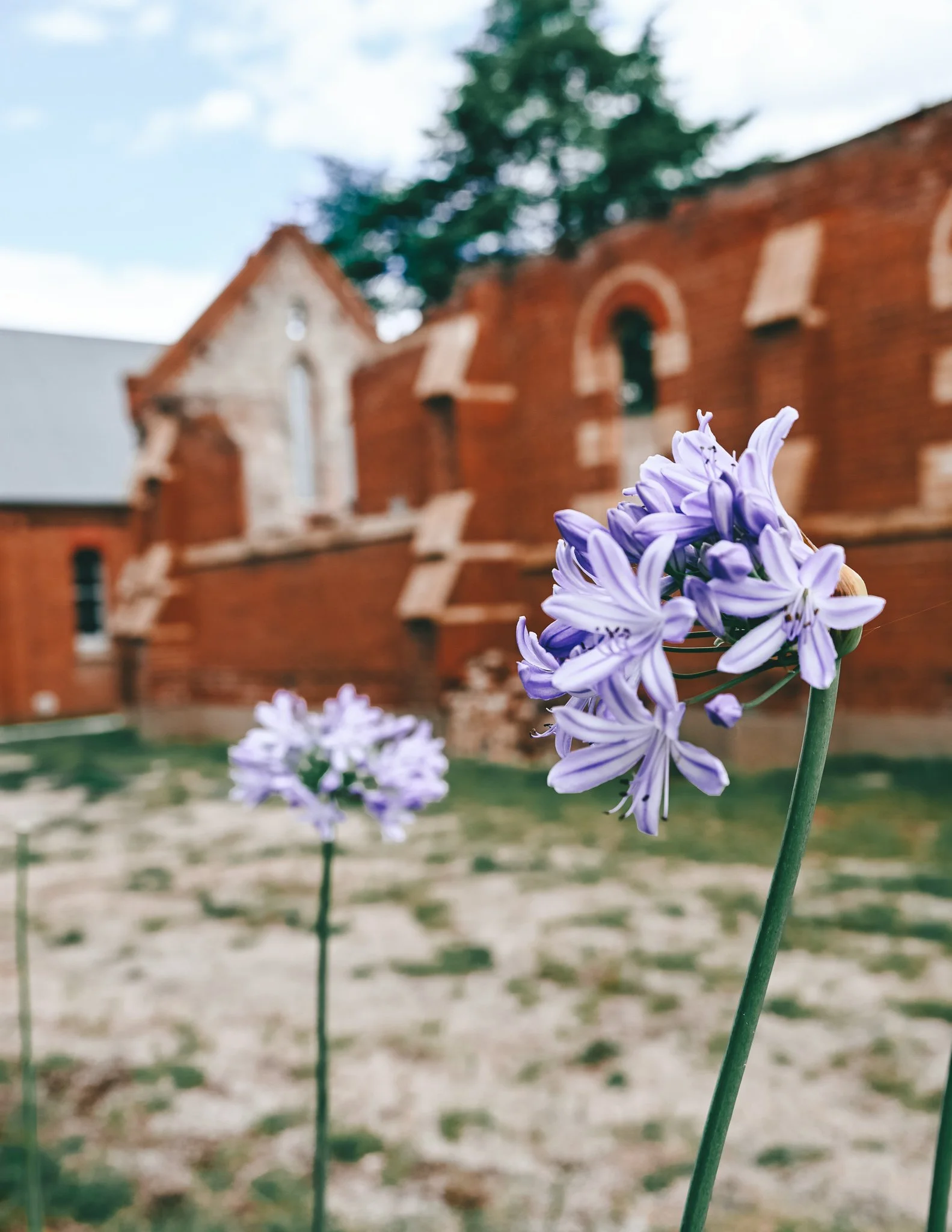
Location 12: The Uniting Church, Perthville
The Uniting Church in Perthville was built in May 1863 (159 years ago). The church was built on land donated by Mr Rodwell. It was a small brick building 30 feet by 15 feet. The church was originally called Wesleyan Church and as there was no village established here at the time it was called the Vale Road Wesleyan Church. Extensions to the church were built by J J Atkins in 1892 (130 years ago) and re-opened on the 24 January 1892. The original builder is unknown.
On 18 April 1959 the Hamer Memorial Hall was opened. A cemetery is located next to the church.


Location 13: Hen and Chickens Inn

Located on the corner of Hen and Chicken Lane & Vale Road.
Ben Hall and his gang of bushrangers visited Samuel Walker the owner of the Inn on the night of the 6 October 1863. The outlaws held up those in the establishment after their visit to Mrs Mutton’s. The police would have come up with them had they kept on the road but the officer in charge decided to take a branch road and kept his men beyond the range of the bushrangers revolvers.
Location 15: The old Abercrombie Shire Office


The AS on the building means Abercrombie Shire.
As always please leave a comment below if I have any information incorrect so I can amend it or if there are any key factors I have missed that I should add to this blog post.
Nadine Travels West.